
|
|
| Post Reply |
| Tweet | Thread Tools |
|
#1
 11th October 2012
|
||||
|
||||
|
Kondisi Barang : Second
Harga : Lokasi Seller : Kalimantan Barat Description : Gps Garmin 420S View Satellite-enhanced Maps 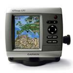 [/quote][quote] [/spoiler] Spoiler for open this:
Spoiler for open this:
Spoiler for open this:
Spoiler for open this:
Spoiler for open this:
Spoiler for open this:
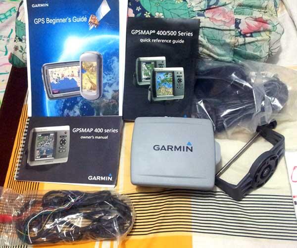
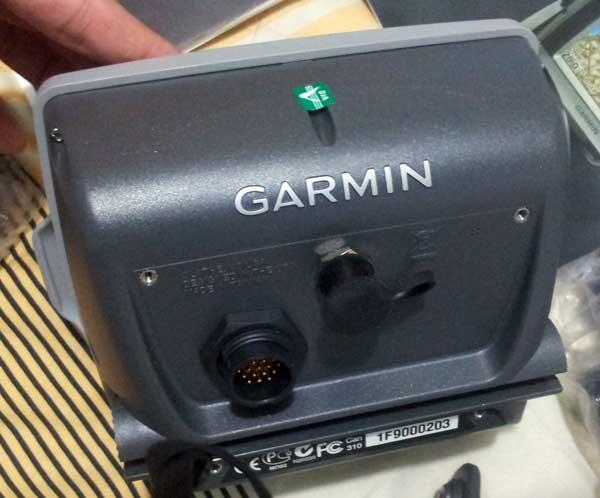
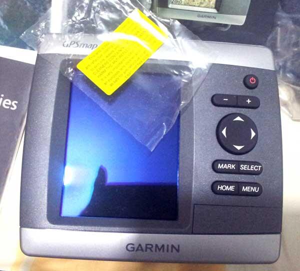
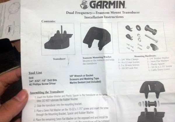 The 420� s basemap contains worldwide satellite images in place of more traditional maps, and its SD card slot makes it easy to add additional maps without connecting to a computer. With fewer keys and a simple, intuitive interface, the 420 makes navigating your way through the water easy. Add Sonar Where applicable, the sounder version, GPSMAP 420s, comes with a powerful dual frequency transducer that clearly paints depth contours, fish targets and structure whether you� re fishing in freshwater or off the coast. The 420 and 420s are also CANet� compatible, so you can share sounder data with another chartplotter on your boat. Add Extras with BlueChart g2 Vision With the optional BlueChart g2 Vision SD card, you can add a whole new dimension of exceptional features to your chartplotter. * 3D mariner� s eye view or fish eye view provides you with a 3-dimensional perspective of map information, both above the waterline and below it. * High-resolution satellite images and aerial photographs help you orient yourself in unfamiliar areas. * Auto Guidance technology searches through all relevant charts to create a route you can actually follow � one that avoids obstacles, shallow water, buoys and other obstructions. Physical & Performance: Unit dimensions, WxHxD: 5.7 " x 5.0 " x 2.7 " ( 14.5 x 12.7 x 6.9 cm) Display size, WxH: 2.4 " x 3.2 " , 4.0 " diagonal ( 6.1 x 8.1 cm, 10.2 cm diagonal) Display resolution, WxH: 240 x 320 pixels Display type: QVGA display Weight: 1.3 lb ( 590 g) Battery: none Battery life: none Waterproof: yes ( IPX7) Antenna: internal NMEA input/ output: NMEA 0183 Maps & Memory: Basemap: yes Preloaded maps: no Ability to add maps: yes Built-in memory: none ( cannot load maps to internal memory) Accepts data cards: SD� card slot Waypoints/ favorites/ locations: 1, 500 Routes: 20 Track log: 10, 000 points; 20 saved tracks Features: Garmin radar compatible: no Garmin sonar compatible: yes CANet� compatible: yes Garmin Marine Network� compatible: no Supports AIS ( tracks target ships' position) : yes Supports DSC ( displays position data from DSC capable VHF radio) : yes Audible alarms: yes Tide tables: yes Hunt/ fish calendar: no Sun and moon information: yes 3D map view: yes ( optional BlueChart g2 Vision) Auto Guidance: yes ( optional BlueChart g2 Vision) Automatic routing ( turn by turn routing on roads) : no XM WX Weather & Radio for U.S. compatible: no Voice prompts ( e.g. " Turn right in 500 ft. " ) : no Remote control: no Headphone jack/ audio line-out: no Audio/ video input/ output: no Portable: no Automotive/ motorcycle-friendly: no in the Box: * GPSMAP 420/ 420s* * Tilt/ swivel mount * Protective front cover * Power/ data cable * Owner' s manual Harga: Rp. 5.500.000,- / Netto Cara Pembayaran: Transfer Bank (T/T), Tunai Jumlah: Ready stock Kemas & Pengiriman: box Contact 0811 573818 |
| Sponsored Links | |
| Space available | |
| Post Reply |
| Thread Tools | |
|
|